Whitepaper: How to Get More Value From Your 911 Systems With The Power of GIS
Public-safety agencies generate vast amounts of data, but without the right tools much of it goes underused.

Public-safety agencies generate vast amounts of data, but without the right tools much of it goes underused.
Mission Critical Partners' informational podcast series features the firm’s subject-matter experts and other industry leaders exploring a wide range of timely topics pertaining to mission-critical communications.
In this episode of the MCP Podcast Network, we present a high level overview of cloud implementations for public sector organizations. We are joined by two Amazon Web Service (AWS) industry thought leaders, John Persano, senior business development manager, and Gigi Boehringer, solutions architect. Eric Caddy, vice president of network and 911 services, and Gary Pulford, the director of product management, both from MCP, also are featured.

Outdoor warning systems (OWS) have played a crucial role in safeguarding communities for decades, serving as indispensable tools for alerting residents about impending disasters
Get ready to elevate your understanding of Next Generation 911 (NG911) systems and tackle the challenges of Next-Generation Core Services (NGCS) deployment! The webinar features Mission Critical Partners’, LLC (MCP) subject matter expert Robert Horne, who will discuss the intricacies of NG911 system implementation, particularly
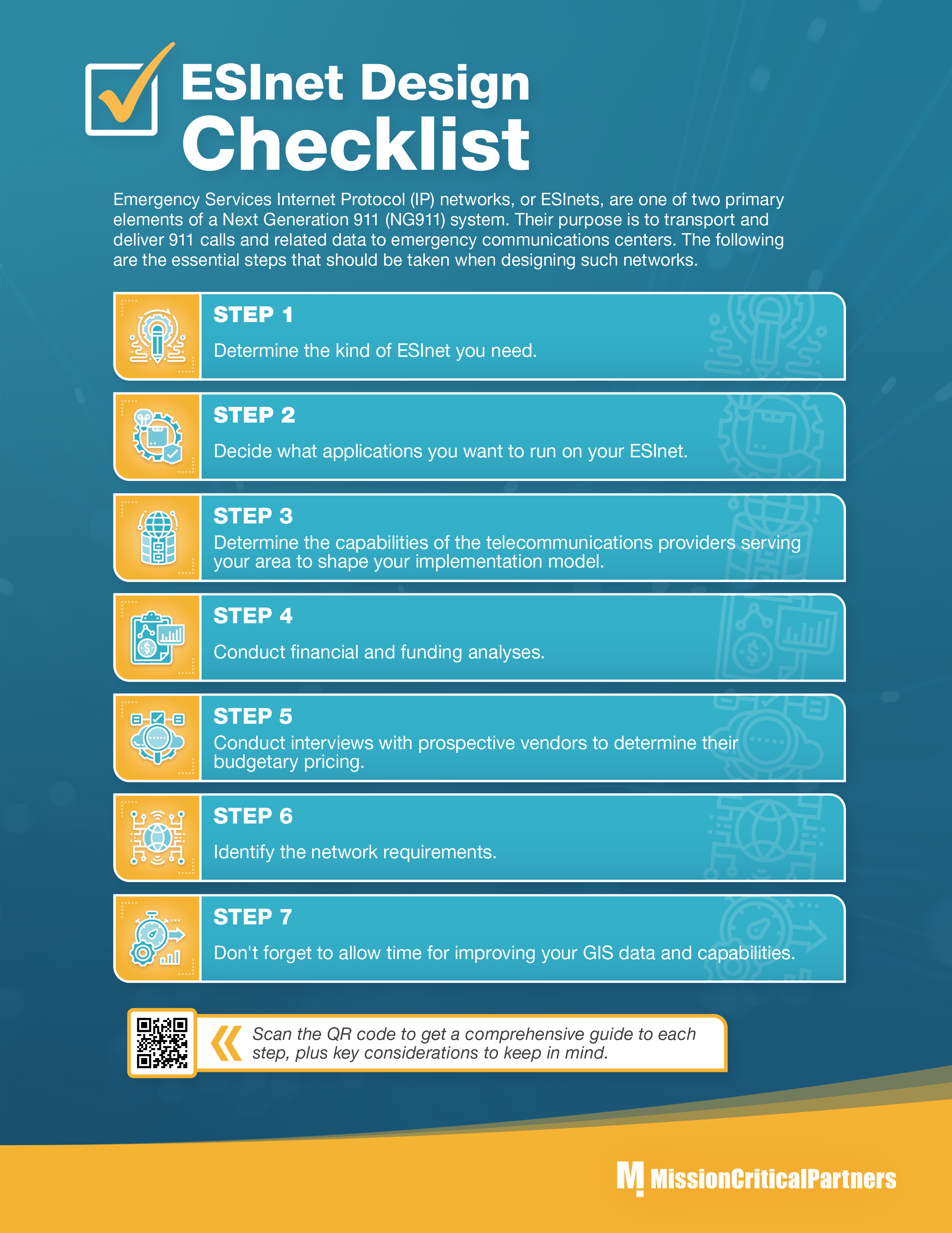
ESInets are emergency services Internet Protocol networks that are used to transport and deliver 911 calls to NG911-compliant emergency communications centers. When designing such networks, the following essential steps should be taken:
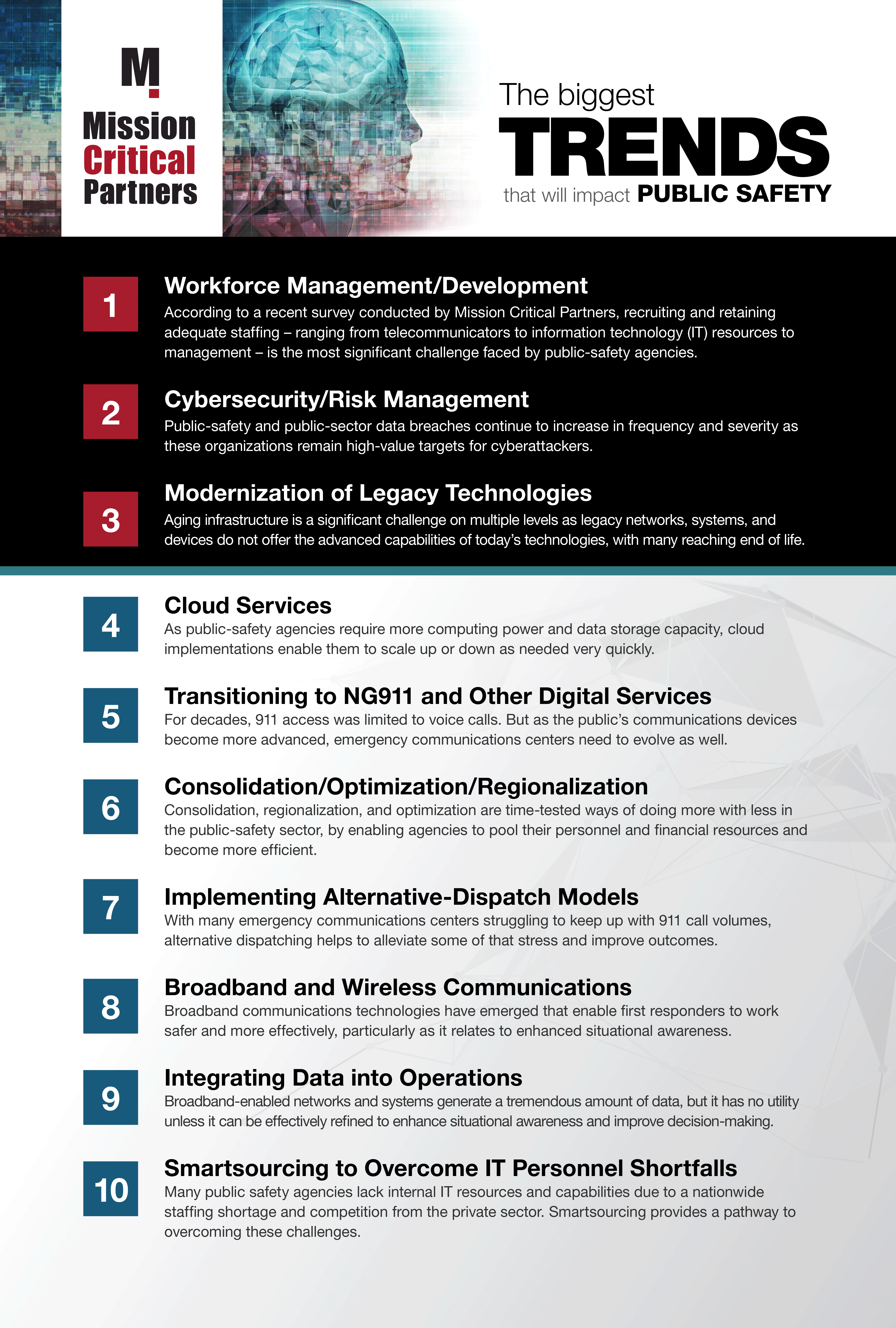
Mission Critical Partners surveyed industry representatives to determine the hottest trends impacting the public safety landscape in the next year. Trends are listed in order based on the volume of responses for each topic.
Next Generation 911 (NG911) systems rely on geospatial routing generated by geographic information systems (GIS) to connect emergency callers and 911 centers. But GIS data first needs to be readied so that it aligns with industry standards and can be used in the NG911 environment.
MCP's informational podcast series features the firm’s subject-matter experts and other industry leaders exploring a wide range of timely topics pertaining to mission-critical communications.
In this episode of the Mission Critical Partners Podcast Network, we discuss Integrating Broadband technology with traditional LMR systems. We are joined by Mission Critical Partners, Scott Neal, Vice President, Director of Wireless Services.
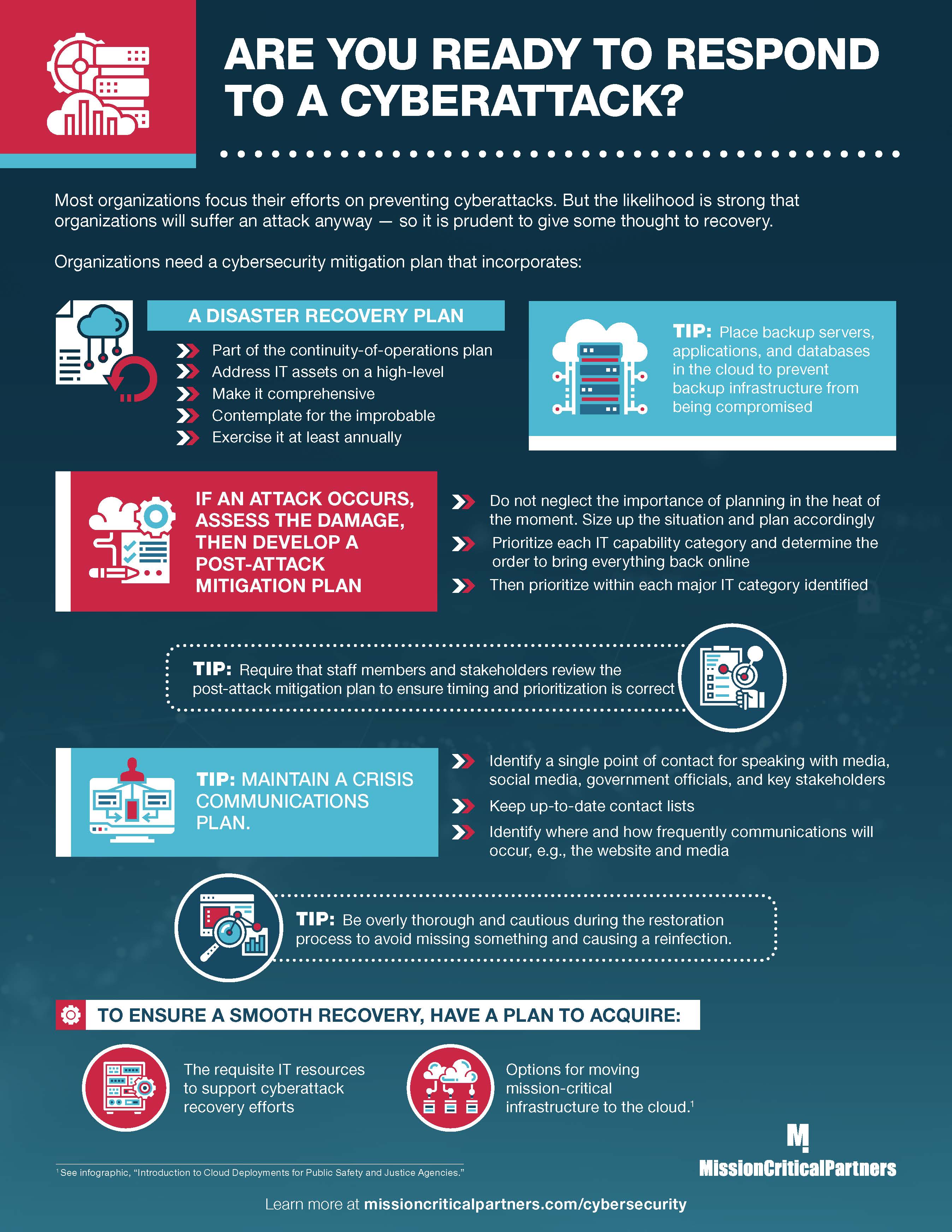
Are you ready to respond to a cyberattack? They are likely to happen and your response plan will have direct bearing on your ability to mitigate such attacks, and on your cybersecurity posture as a whole.
.jpg)
Benefits gained from a cloud-based solution are considerable compared with traditional implementations methods. Not only are more state and federal public safety agencies moving the cloud, but cloud-based solutions also are being leveraged by mission-critical entities such as the

MCP's informational podcast series features the firm’s subject-matter experts and other industry leaders exploring a wide range of timely topics pertaining to mission-critical communications.
In this episode of the Mission Critical Partners Podcast Network, we are discussing cloud migration factors to consider for public sector organizations. We are joined by three Mission Critical Partners, Eric Caddy, Vice President and Director of Network and 911 Services, Jamie Sullivan, Senior Technical Specialist, and Gary Pulford, Director of Product Management.
MCP's informational podcast series features the firm’s subject-matter experts and other industry leaders exploring a wide range of timely topics pertaining to mission-critical communications.
In this episode of the Mission Critical Partners Podcast Network, we discuss the benefits of cloud implementations for public sector organizations. We are joined by three Mission Critical Partners, Eric Caddy, Vice President and Director of Network at 911, Jamie Sullivan, senior technical specialist, and Gary Pulford, Director of Product Management.
How can we support your mission? From design and procurement to building and management, our national team of experts is here to help…because the mission matters.
![]()
A: 690 Grays Woods Blvd., Port Matilda, PA 16870
P: 888.862.7911

![]()
![]()
![]()
![]()
![]()