
Infographics Geographic Information Systems

Infographic: Myth Busting – GIS & NG911

Jason Muenzer February 7, 2023 0 min read

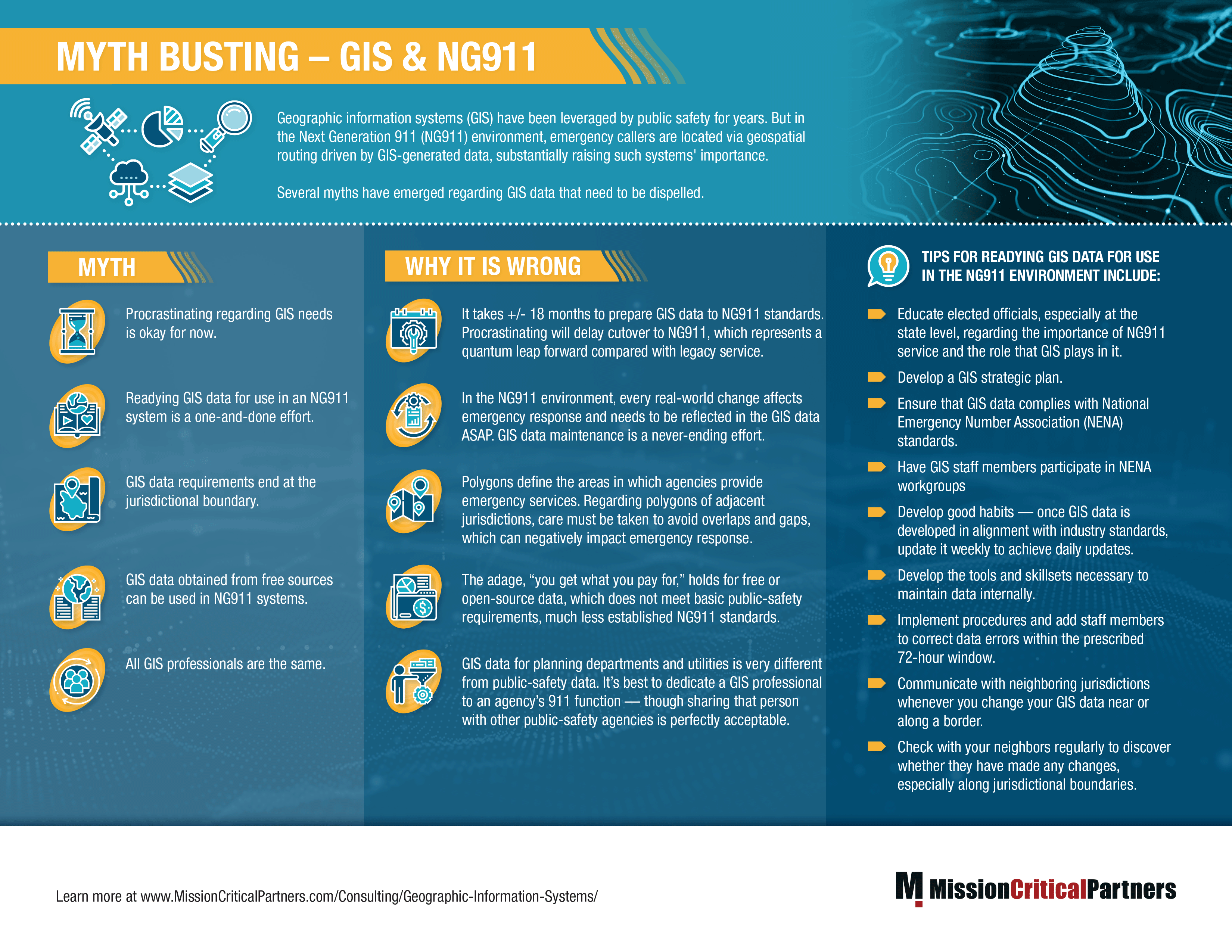
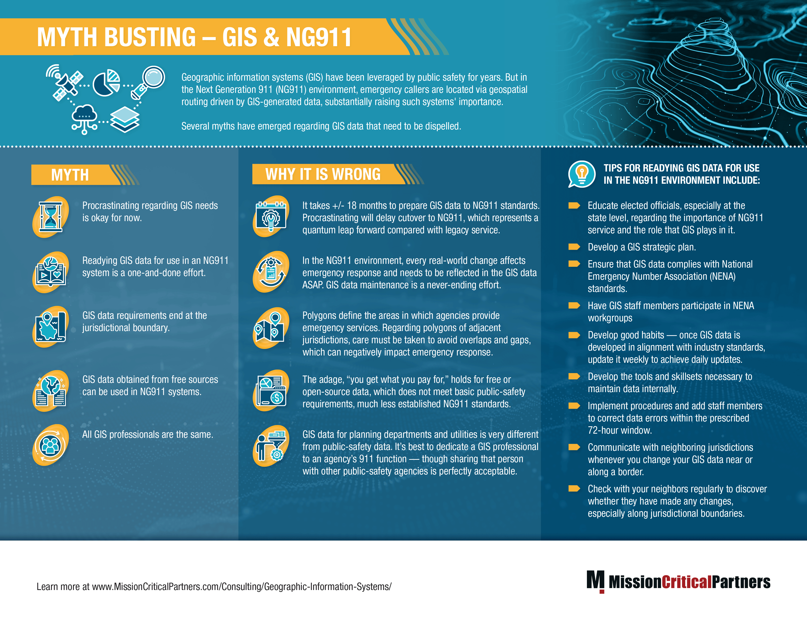
Geographic information systems (GIS) have been leveraged by public safety for years. But in the Next Generation 911 (NG911) environment, emergency callers are located via geospatial routing driven by GIS-generated data, substantially raising such systems' importance, and this infographic dispels the several myths that have emerged regarding GIS data.
Infographic---GIS-Data---Final


Don't forget to share this post!

Jason Muenzer

Related posts

Next Generation 911 Networks On-Demand Webinars

On-Demand Webinar: Cracking the Code of NG911 Deployment

July 10, 2023
Jason Muenzer
Please upload the image
Next Generation 911 Networks Technology Emergency Response Ecosystem Public Safety Data White Papers

The Technical Evolution of the PSAP in a NG911 and Public Safety Broadband Environment

August 1, 2017
Morgan Sava
Please upload the image
Next Generation 911 Networks Wireless & Broadband Consulting Emergency Response Ecosystem On-Demand Webinars

On-Demand Webinar: FirstNet and NG911 Convergence: The New Public Safety Communications Platform

October 1, 2017
Morgan Sava